

 Revelstoke, BC Traffic Cameras
 Revelstoke Live Traffic Map
 DOT Accident Reports
 Revelstoke Live Traffic Chat Room
 Revelstoke Archives
Recent Revelstoke British Columbia DUIs
No news clip matched your search criteras.
Click here to search our Revelstoke British Columbia Archives
You could also use our search engine Below to find what you're looking for
Click here to search our Revelstoke British Columbia Archives
You could also use our search engine Below to find what you're looking for
 1 HWY-1 Revelstoke Accidents
 Other British Columbia Cities
Revelstoke British Columbia Live Traffic Cams
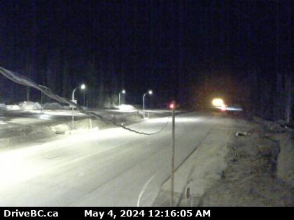
Hwy-23, near the Upper Arrow Lake ferry landing at Shelter Bay, middle of queue, looking north. (elevation: 455 metres)
For inland ferry information visit Inland Ferry Schedules, and DriveBC for inland ferry incidents or delays. Traffic Cam
For inland ferry information visit Inland Ferry Schedules, and DriveBC for inland ferry incidents or delays.
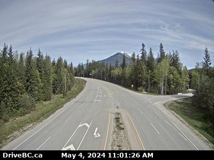
Hwy-1, about 33 km west of Revelstoke, looking east. (elevation: 438 metres) Traffic Cam
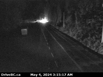
Hwy-1, near Parks Headquarters at Glacier National Park, 72 km east of Revelstoke, looking east. (elevation: 1330 metres) Traffic Cam
DOT Accident and Construction Reports
-
TYPE: Miscellaneous
-
TYPE: Construction Moderate
-
TYPE: Construction Moderate
-
TYPE: Construction Moderate
 Highway 1 (TransCanada Highway), in both directions. Watch for falling rocks between Eagle
 Revelstoke Motorcycle Accidents
 Revelstoke Truck Accidents
 Revelstoke Fatal Accidents
 Revelstoke Car Accidents
 62° F
62° F